Thursday, May 13, 2010

RIP Professor M. Gordon (Reds) Wolman August 16, 1924 - February 24, 2010

I was saddened to discover the other day that Professor M. Gordon “Reds” Wolman passed away in February.  For those who don’t know, Reds Wolman was a pioneer in the research of river/stream bankfull flow concepts with Luna Leopold in the 50 & 60’s.   The 1.5 year frequency bankfull flow calculations used frequently in stream restoration design are based upon his work.  You can see Professor Wolman in a US Forest Service introductory video to bankfull flow – it can be viewed here: link to video.

Peter Wilcock of the National Center for Earth-Surface Dynamics penned a short obituary:

_________________________________

6a00d8341bf80a53ef0120a8da8799970b-320wi

“M. Gordon (Reds) Wolman

August 16, 1924 - February 24, 2010

Prof. Wolman's career was defined by fundamental contributions to our understanding of rivers, supported by pioneering work in developing interdisciplinary environmental education and an extraordinary commitment to the application of research to river management and policy.

In his Ph.D. research at Harvard University and subsequent work with Luna Leopold at the U.S. Geological Survey, Prof. Wolman played a central role in defining rivers in a modern, quantitative and generalizable framework that still provides the standard against which new models and concepts are evaluated. The understanding and the methods developed in this work form the foundation of modern river geomorphology, engineering, and restoration. Building on this work, Prof. Wolman addressed a fundamental problem in river science: the magnitude and frequency of the processes that shape rivers and their ecosystems. Is it the rare and destructive storm that sets the size, shape and composition of river channels, or the small, persistent flows, or something in between? With his colleague John Miller, Prof. Wolman demonstrated that relatively common floods do the most work in shaping river channels and, further, that there is remarkable consistency in the frequency of these 'effective' floods. This result has guided interpretation of rivers and challenged river theory for the past 50 years, while also providing a key element of modern channel restoration and design. Prof. Wolman's contribution extends to the pervasive impact of urbanization on rivers. With his colleague Asher Schick, he documented the impact of urbanization on stream channels, developing a characteristic sequence of events that defines the standard model against which impacts and remediation are evaluated.

Committed to the idea that environmental stewardship requires knowledge that is both deep and broad, Reds played a leading role--by personal example, by academic leadership at Johns Hopkins University, and by advising many academic and research programs--in defining the nature and scope of effective, rigorous, and interdisciplinary environmental education.

The link between science and society was not an abstract theme for Reds, but a path to action. Reds contributed sustained service and frequent chairmanship of National Academy Commissions, Boards, and Committees dealing with water management and policy. He also provided expert guidance to Resources for the Future, the World Health Organization, the International Scientific Committee on Problems of the Environment, the International Institute for Applied Systems Analysis, Oak Ridge National Laboratory, Savannah River Plant, and the State of Maryland among others. His indefatigable service, combined with his good-natured wisdom, influenced environmental decisions and decision-makers around the world.

For those who knew him, Reds' professional accomplishments merely provide context for his greater personal contributions through his inspired combination of warmth, wit, and genuine affection for all he came into contact with.

The whole exceeded the sum of the parts. Reds was a distinguished scholar who played a central role in defining our modern understanding of rivers, a visionary academic who pioneered integrated environmental education, a devoted citizen who worked tirelessly to apply an understanding of rivers to their protection and wise use, and an extraordinary human being who inspired and delighted generations of students and colleagues, all friends.”

From: http://www.nced.umn.edu/content/tribute-reds-wolman-peter-wilcock

Monday, May 10, 2010

Converting a Drawing Datum in AutoCAD Map 3D 2011

Converting your drawing’s datum in not a straightforward, user-friendly task in Map 3D. It is not difficult to do, though, and can be mastered after some trial and error. Two separate DWG files are used for this procedure – one with the original linework in the original datum; the second in a new DWG in the datum to be converted to.

Begin by setting up a DWG in the datum you wish to convert to.

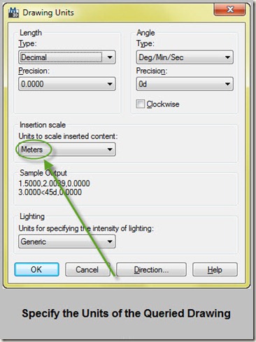
Next, if the datums are in different units, then use the UNITS command. In this example, the drawing being queried is in meters (UTM WGS-84), and the native drawing is in feet (VA State Plane South). The Insertion Scale is set to the imported drawing’s units which is meters.

specify units of queried drawing

Begin the Define Query command under Tool Ribbon>Create>Object Query.

define query

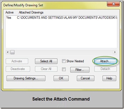
The Define Query command sets up parameters for importing drawing information from other DWG files. The DWG you wish to convert the datum for is attached here.

Select Drawings for Querying

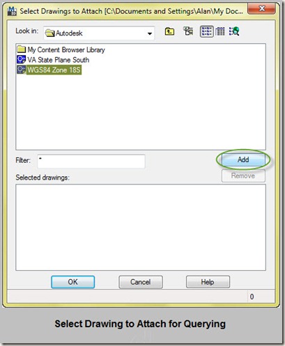
Select the relevant drawing and add.

select drawing to attach

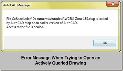
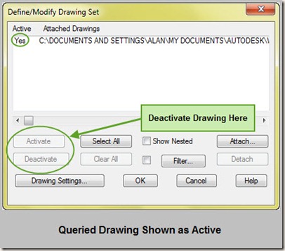
Drawing are locked when they are actively queried.

error message trying to open queried drawing

The Define Query>Drawings command shows the currently active drawings. Choose deactivate or close out the drawing exectuing the query command in order to reopen the locked DWG.

Active Drawing

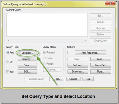
Now set the query type. There are all sorts of different queries that can be performed:

Location Query based on boundary conditions
Property Query based on properties such as linetype, layer, color, etc
Data Query based on attached object data attached to drawing objects
SQL Query based on externally linked SQL database

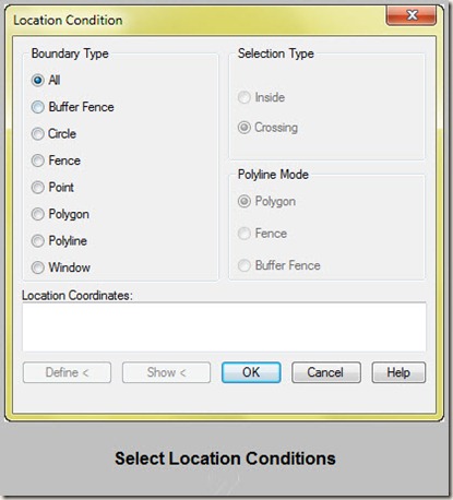
In order to grab all drawing objects for datum conversion, choose "Location" for query type. Select "All" for boundary conditions (brings in all drawing objects).

set query type

Set location condtion

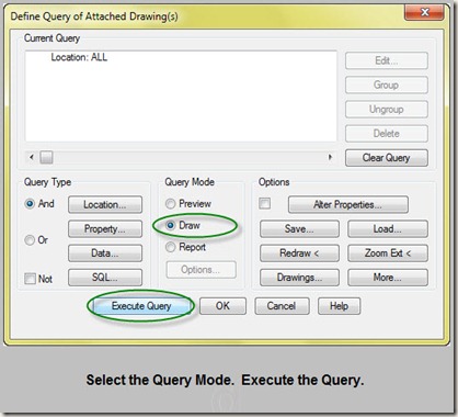
Now that Drawings and Query Type are selected in the dialog box, choose the Query Mode. Select Draw to bring queried data into the drawing.

execute the query

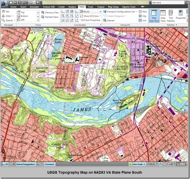
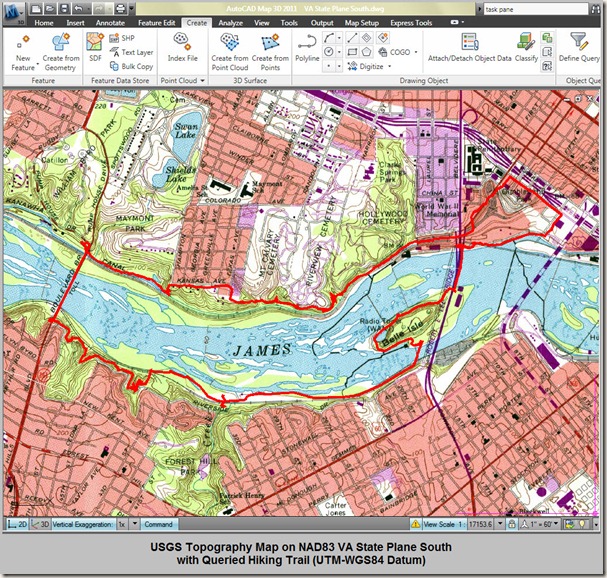
USGS Topography showing before/after querying:

VA State Plane South Zone NAD83

VA State Plane South Zone NAD83 with Queried Trail

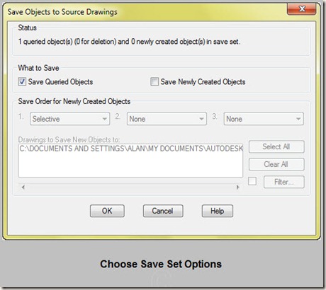
When edits are made to the queried objects, a dialog appears asking if the object should be added to the save set. The save set consists of objects that were created or modified in the current drawing and are marked to be saved back to source drawings. Additional save set options are given if the objects are added.
Save Set Save Options

Choose Save Options for Queried Objects

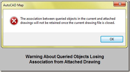
When closing the drawing, a warning will appear that the active link between drawings will be lost.
Assocation will be dropped message

This just a little snippet of what can be done with querying. Much more can be done with the command. See the Autodesk Map 3D Help Page regarding querying topics or experiment with the command to learn more.

Sunday, May 9, 2010

Live Track Your Civil 3D Drawing with GPS in Google Earth

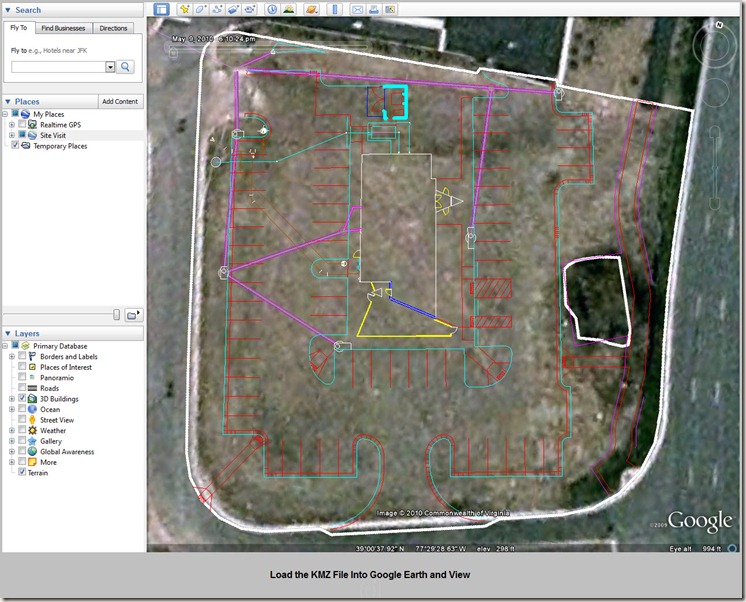
Site visits are essential to well designed plans.  Visualizing how future plan sets will appear in the field can be difficult without being able to efficiently georeference your current location  in relation to your proposed plans.  However, by using now ubiquitous technology, your current location on your future plan sets can be viewed easily.  To do this, Google Earth is used in conjunction with a handheld Garmin GPS Unit and a laptop with an active internet connection (ie. tethered phone, network card..or cached images).  The proposed plans are exported to Google Earth in KML/KMZ  format; Google Earth is set to live GPS tracking; and the mobile internet connection will facilitate imagery regeneration.

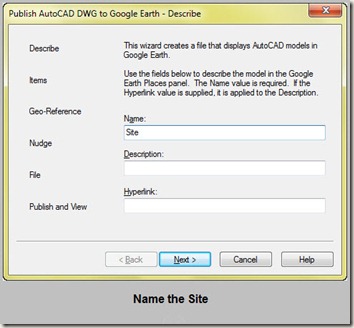
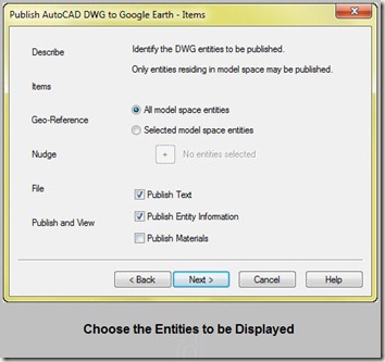
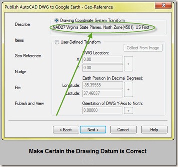
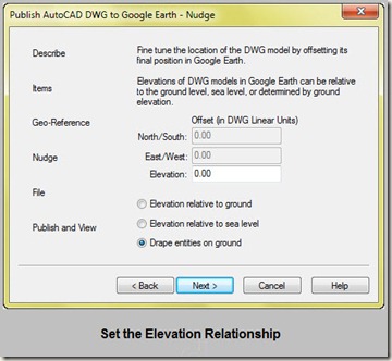
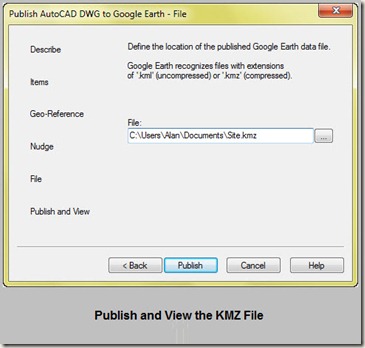
Begin by exporting the drawing for use in Google Earth.  Use the command “PublishKML” to export to a KMZ/KML file. 

name the site

choose entities

correct datum

elevation relationship

publish and view

 load kmz file

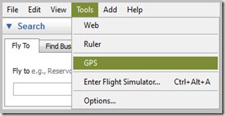
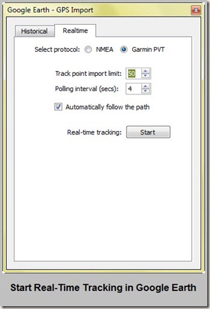
Turn on real-time GPS tracking in Google Earth under Tools>GPS in the menu bar.  Select the Garmin PVT protocol and the interval desired between location refreshes.  Start the real-time tracking.

GE tools-gps

google earth gps import

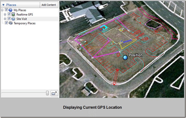
View your current location on Google Earth in relation to your site’s linework.

Displaying Current GPS Location

Need to Quickly Georeference an Image? Use ADETRANSFORM in Map 3D

With two known landmarks in a drawing, an image can be very quickly rotated and scaled using the corresponding landmark locations from the image using ADETRANSFORM

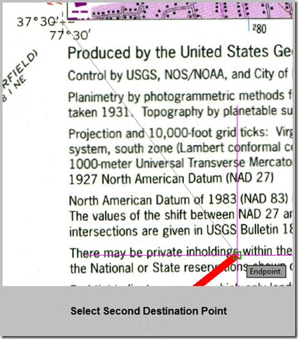
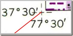
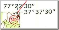
In this example, a USGS topography map is correctly rotated and scaled by referencing its NAD83 tick marks.  The lat/long for the tick marks were placed in the drawing using the MAPTRACKCS command (the end of the red polylines are the tick mark locations in the drawing).

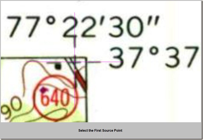
Begin the ADETRANSFORM command in Map 3D.   For the first source point, select a point on the image to be georeferenced.

select first source point

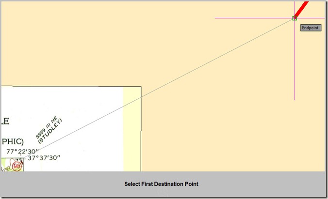
Select the corresponding destination point in the drawing.

first destination point

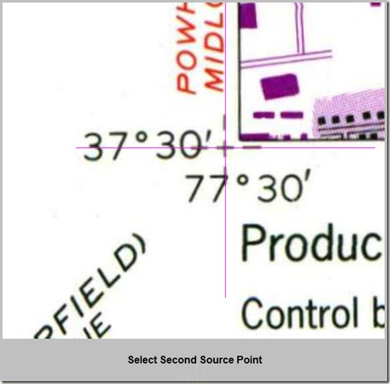
For the second source point, select a point on the image to be georeferenced.

 select second source point

Select the corresponding destination point.

select second destination

Success!  The image lines up under the destination points selected.

second point succeed first point succedd

Place an Object with Lat/Long (Degree/Minute/Seconds) Points into AutoCAD Map 3D 2011

Have points in degree/minute/second format, but absolutely no clue how to easily import them accurately?  Use the Coordinate track command under Analyze>Geo Tools in the Ribbon.

coordinate track

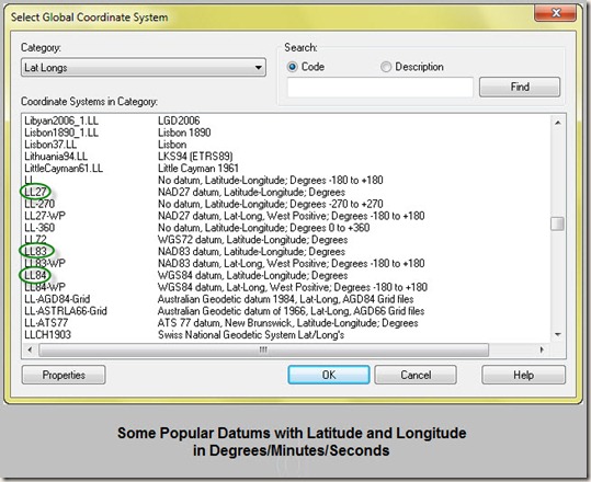
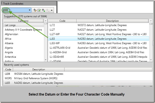
Coordinate track opens up a separate window.   This command displays drawing coordinates in a different datum.  To display latitude and longitude coordinates, select the relevant datum. 

 popular datums

Most GPS based systems report Lat/Long in WGS84 format (LL84).  However, this example is referencing tick marks placed on a UGSG topo map that references the NAD83 datum.  The code LL83 is entered for NAD83 and can be entered manually to save time.

 enter ll84

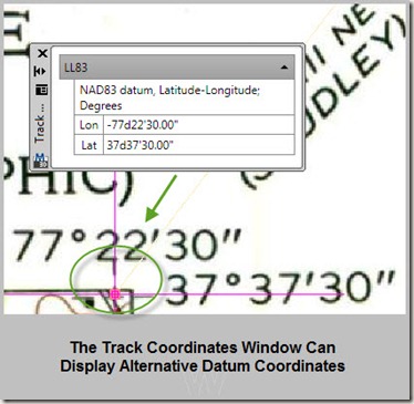
Shown below, the drawing is in Virginia State Plane South, NAD83 Feet.   However, the Track Coordinates Window displays coordinates for the alternatively chosen datum,  NAD83 in latitude and longitude in degrees/minutes/seconds format.

track coordinates 

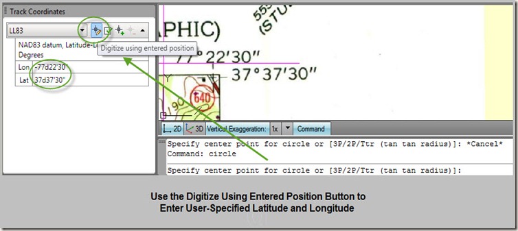
To place an object on user specified coordinates, start the drawing command.  When the point is asked for, goto the Track Coordinates window and select the “Digitize using entered position” command as shown.

digitize using entered position 

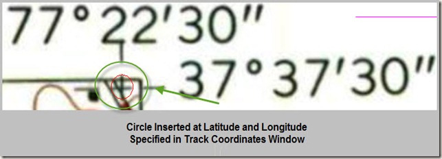
The drawing object is placed at the specified Lat/Long coordinates.  Notice how it is directly centered on the NAD83 tick mark placed by the USGS.

circle entered at lat long

**Please note, there appears to be a bug in the command that causes Map 3D to severly slowdown after initializing the “Digitize Using Entered Position” command.  Make certain (as always) that your work is backed up Map 3D will probably need to be restarted.

Friday, May 7, 2010

Import Garmin Mapsource Data into AutoCAD & Civil 3D

Garmin Mapsource tracks can be imported into AutoCAD & Civil 3D with some easy steps

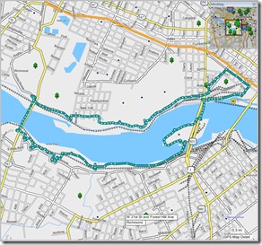
mapsource track view verify ge image
 
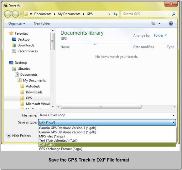
Begin by saving your Mapsource track in the DXF file format
 
save track in dxf
 
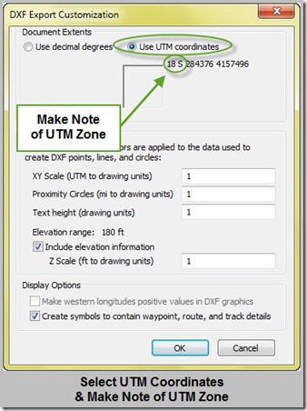
Make note of the UTM zone for your datum settings in AutoCAD or Civil 3D. Use the dialog box settings as shown for saving the DXF file. A 3D polyline will be created if the Include elevation information box is checked, otherwise the track will be a normal polyline.
 
select utm coordinates
 
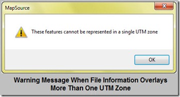
A warning message appears if the track/waypoint information overlays more than one UTM Zone
 
warning message
 
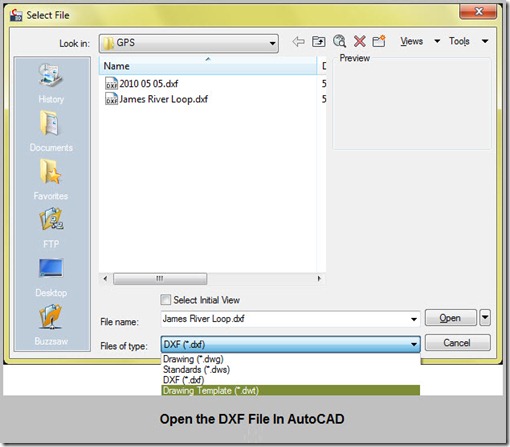
Now open the DXF file in AutoCAD. Make certain that DXF file is selected as the file type.
 
open dxf file
 
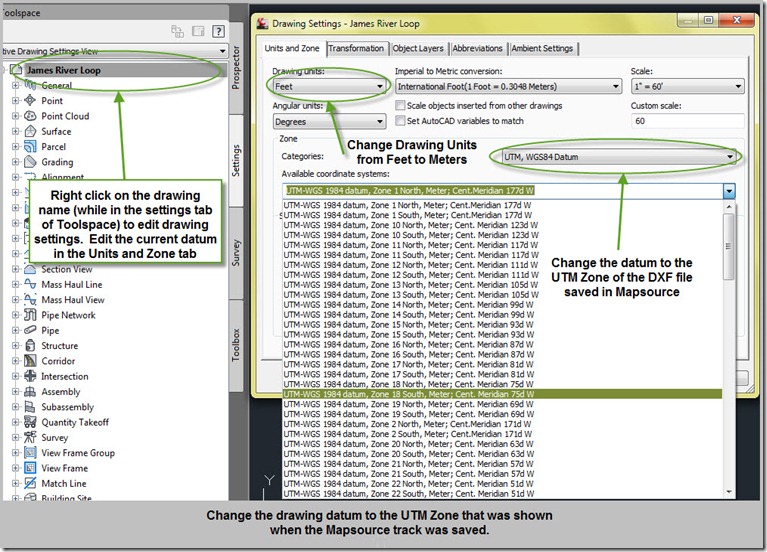
If the DXF is being edited in Civil 3D, and not just vanilla autoCAD, then adjust the datum of the DXF file just opened to be the same datum of the Mapsource tracks and waypoints that were just saved. The datum will be in the UTM-WGS 84 as shown in the dialog box below. Also, BE SURE TO CHANGE DRAWING UNITS TO METERS.
change datum
 
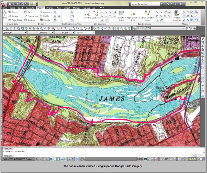
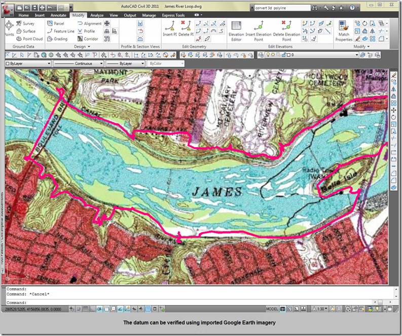
The track is now imported into AutoCAD Civil 3D on the UTM84 datum. The drawing may now be saved in DWG format. Additionally, the datum can be verified as correct by using the Google Earth imagery import function under Insert>Import (in Civil 3D). If the tracks overlay the Google Earth image (shown below is Google Earth imagery with overlay USGS topography), then the drawing settings are correct.
 
verify ge image
 
Additional steps are required to display the track in a different datum. See my post at http://civil3d.streamrestoration.info/2010/05/converting-drawing-datum-in-autocad-map.html for more details.

Thursday, May 6, 2010

Overlay USGS Topography in Google Earth

Referring back to my last post on network links, there are also many published kmz files on the web of network links to online Google Earth GIS information. One of the kmz files I particularly enjoy overlays USGS Topography Maps. This can be very useful when used with the Google Earth image/surface functionality of Civil 3D. The KMZ file for viewing USGS topography is available here: topomaps.kmz

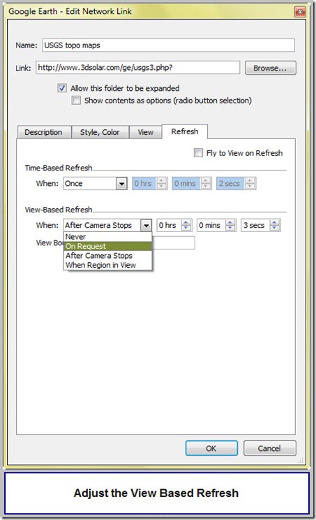
Adjustments can be made to the desired method of refreshing by right clicking on the network link and going to the properties menu. I prefer to change the refresh to On Request. The topo maps do not constantly refresh as the vantage point is moved for On Request.

view based refresh

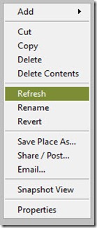
To refresh the view, right click on the network link and select refresh.

refresh

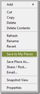
To permanently save this network link to your GE database, right click and select Save to My Places.

save to my places

GE Kings Peak

DSC_0264

Use Network Links to Make Google Earth Load Faster

Google Earth is a superb GIS database resource. You can save all sorts of geographic information to GE, and it will all display every time you start the program. However, every time you save something to your My Places Folder (the method for storing database in GE), it is saved to a single My Places KMZ file that can become very large, cumbersome, and difficult for GE to process upon startup. There is a fairly simple workaround to the inefficiency of storing all your Google Earth Database on one KMZ file.

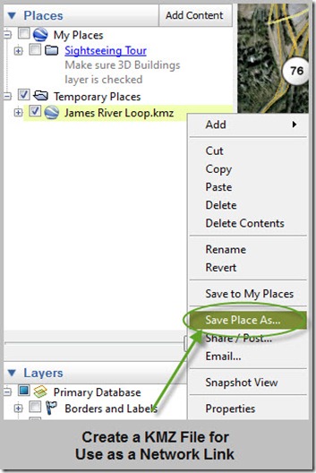
First you have to create a KMZ file seperate from your My Places KMZ file. When you GIS information is temporarily stored in GE, it is located in the Temporary Places Folder. From here, it can be saved to either you My Places Folder (which will make it large and unwieldy), or you can save it separately. A KMZ file can also be created from within the My Places folder.

Save the link to a separate location – this will be used for setting up the network link.

save kmz file

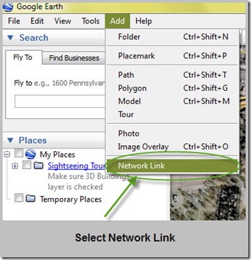
Add the Network Link

select network link

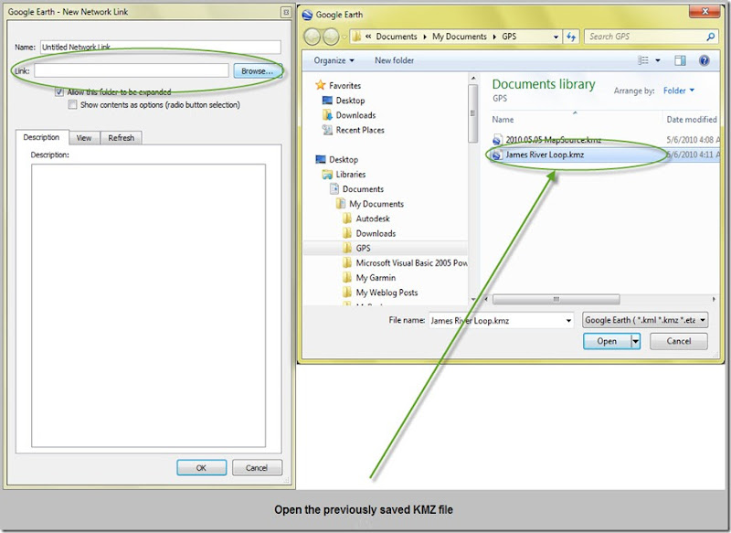
Select the KMZ file previously saved from the Temporary Places Folder

open saved kmz file

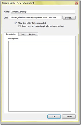
Name the KMZ File as it should appear in the My Places Folder

named network link

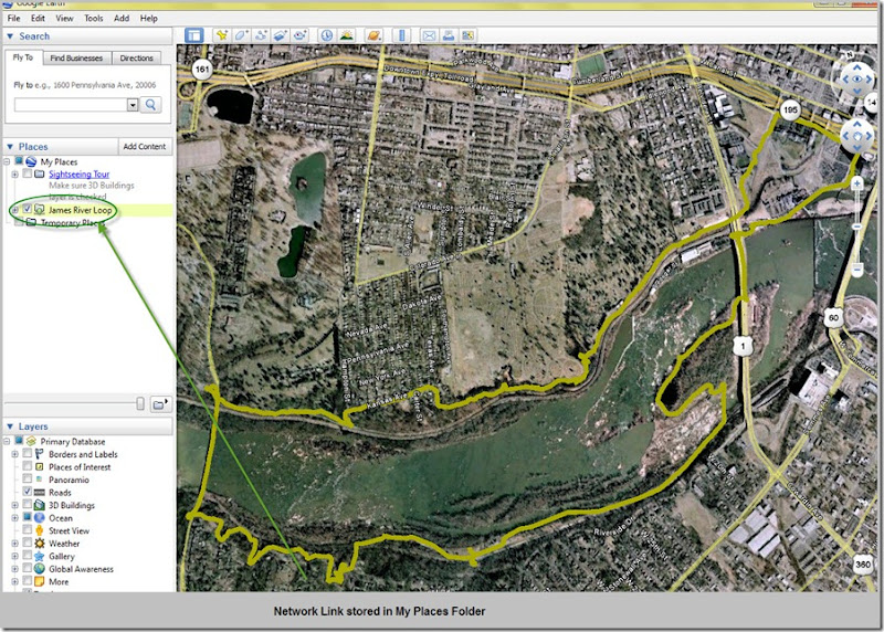
The Network Link is stored in the My Places folder. This significantly reduces the core database size being loaded at startup, and makes Google Earth much faster.

stored network link