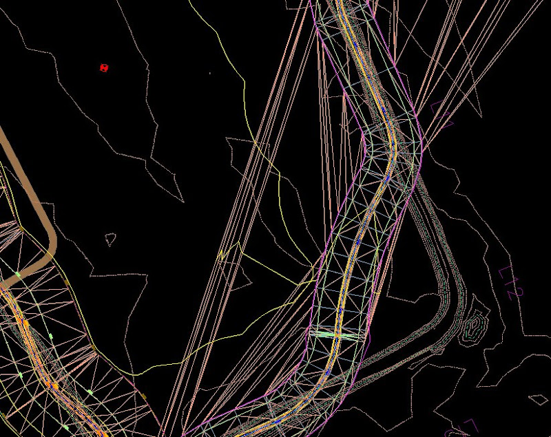
Stray triangulation in corridor modeling can be easily fixed:
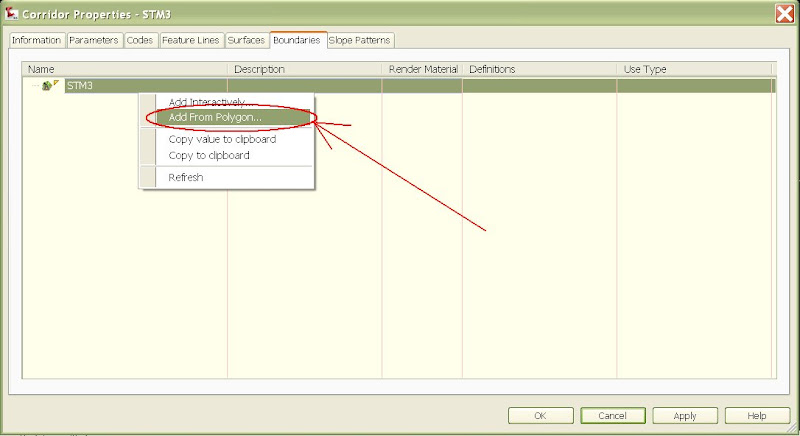
Go to corridor properties, then the boundaries menu. Right click on the surface and select "Add from polygon". Create polylines from your corridor feature lines and join them to form a large closed polyline encompassing your corridor surface. This boundary is static in memory and is NOT updated as you change the original polyline you selected. In fact, you can delete that polyline if you wish and the boundary will remain in memory. The boudary function is a fantastic way of deleting links from a surface tinn by simply excluding them outside of the corridor boundary. The closed polyline boundary is much easier to use than the corridor feature lines (method shown in previous post before this one):
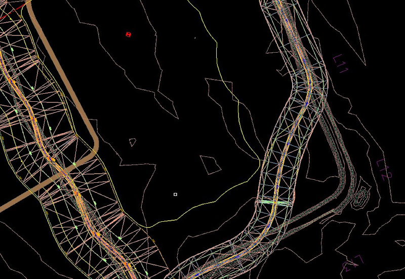
Finished Product:
Thursday, January 29, 2009
Blog Archive
-
▼
2009
(23)
-
▼
January
(21)
- Revert the Layer Properties Manager Back to Static...
- Use Static Polylines for Corridor Boundaries
- Use Corridor Feature Lines for Surface Boundaries
- Editing Profile Data via the Panorama Editor
- $1,000,000 fine levied by Justice Department for C...
- Map Cleanup and Topology Buffers
- Remove Zero Elevation Contours on Corridor Surfaces
- Group Filters for Easier Layer Managment in Civil 3D
- Link a Corridor Subassembly to a Feature Line
- Make alignment text controlled by civil 3D object ...
- New 09' Feature Line Select Option
- Problems deleting bad alignments
- Import Garmin Mapsource GPS tracks into AutoCAD & ...
- TR-55 Hydrologic Analysis with Map3D
- Natural Channel Design via Corridor Modeling
- Civil3D Object Color Control
- Data Extraction Command
- Visibility Function on Dynamic Blocks
- Purge Command
- Panorama Editor
- Using Profiles to Import Elevations
-
▼
January
(21)